This week we concluded the Homeland Security portion of the course by using the data we prepared last week. We were focusing on the Boston Marathon bombings and security & surveillance. The first map we created shows the 10 closest hospitals to the finish line. Here we took into consideration the types of hospitals and only focused on the non-specialized, non-campus, non-rehab hospitals. You can see the hospitals are labeled and the local streets were provided as some reference. I also included an inset map giving you a better idea of where we're focusing.
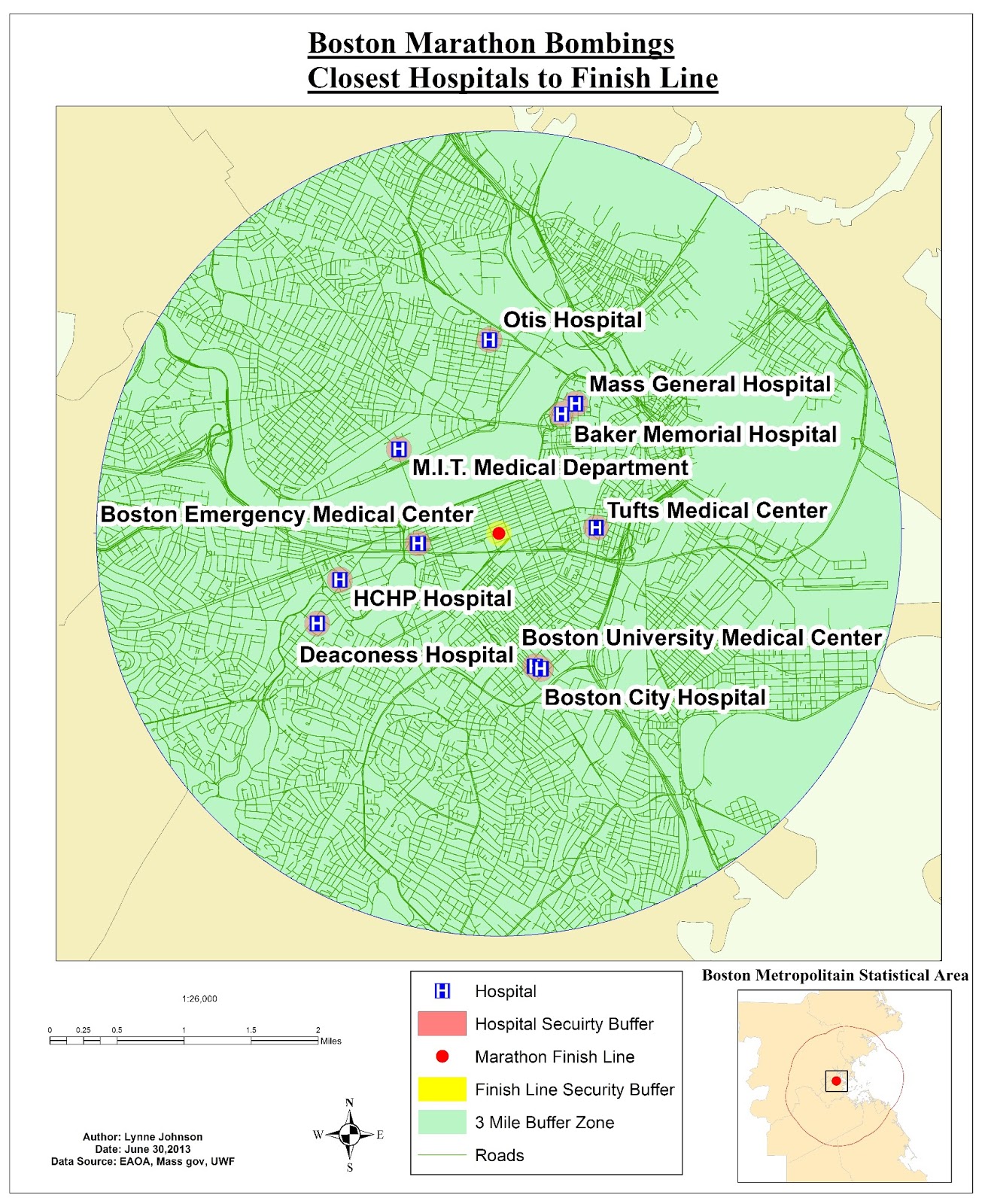 |
| 10 closest hospitals to the marathon finish line |
The second map we created as a security check point buffer. We created a 500 foot buffer zone around the finish line and placed security checkpoints around the perimeter. The location of the check points were created where the security zone intersects with the roads. Again, an inset map was provided for reference.
 |
| Security perimeter checkpoint locations surrounding the finish line. |
Finally, the third map I created is a surveillance and line of sight map. We used hillshade and viewshed. Hillshade allows you to view where the sun's shade will be at a specific time of day using the altitude and azimuth of a certain location. The viewshed uses the surveillance points to show you what will and will not be visible. In this particular map, green is visible and pink is not. Using the 3D-Analyst tool, I then mapped out a few points and used the finish line as the target location. There you can see along that line of sight path, where obstruction are. The red portion of the line is an obstruction and the green is a clear path.
 |
| Line of sight and surveillance map of the Boston Marathon finish line. |
No comments:
Post a Comment