This week we were introduced to ERDAS Imagine, which is an image processing application. I've been seeing it on my eLearning Desktop for a while now and now we're finally diving into it. This week was a basic run-down of how to use the application. Menu bars, sub-menus, how to create a subset of an image. Unfortunately, the program still seems to need some work because we needed to export our subset image to ArcMap in order to add the finishing touches. I am hesitant to get excited about a program that might crash often. That just seems like a lot of frustration. However, I suppose, in the long run, it'll be good to have at least a basic understanding of what it has to offer.
Below is the subset image we transferred from ERDAS Imagine to ArcMap. It's a classification map showing how many hectares are occupied by that certain class. It's a basic map but it involved some learning in ERDAS, which was the point.
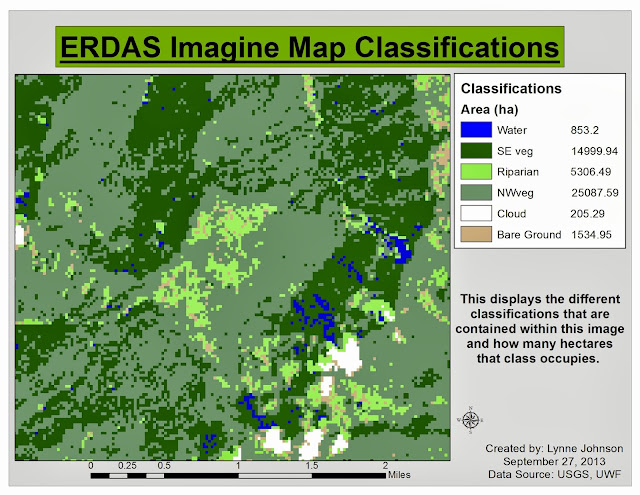 |
| Each classification is color coded and labeled with the number of hectares it occupies. |

No comments:
Post a Comment