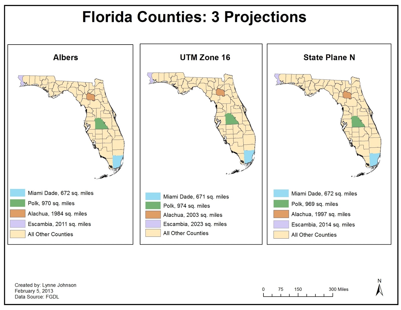
This is a map using three different map projections. You can see major differences by the changes in square mileage in each of the four counties. One subtle difference is the angle at which the maps are displayed. They are slightly different. The three different map projections used in this case are Albers, UTM Zone 16 and State Plane N.
No comments:
Post a Comment